Basin modeling in frontier areas is challenging because there is very little data to use to start the calibration process. Integration of multidisciplinary technologies results in a simplified reservoir drilling model for the mini-basin. Getting the most out of seismic facies interpretation/analysis increases the reliability to identify and map the reservoir zones and sealing (trapping) mechanisms. Boundary conditions which reduce or block fluid escape from compacting strata can be sub-cropping formations caused by erosional unconformity or faulting.
The approach used by BPI is based on a unified, consistent solution which accounts for:
The basis for the oil and gas and water migration is presented in this paper: Link.
Baird Petrophysical has proprietary basin modeling software and experience to create a drilling model of the geologic mini-basin planned to be drilled. Contact us for more information. Ask about our unique well planning tools and displays. Our policy is to show our clients but not to publish them here.
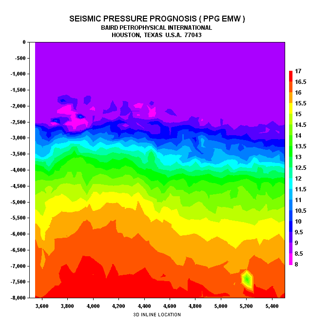
Example 2D Seismic Pressure Prognosis ( PPG EMW ). Baird prepares visuals for drillers. The above is a cross-section in TVD depth of the BPI Estimated Pore Pressure Gradient in pounds per gallon mud weight equivalents.
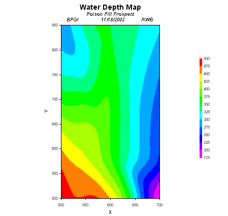
Example Water Depth Map. Depth to Drilling Horizon Water Depth. Baird prepares Depth to 12.5 PPG Maps, or any mapable, important, useful feature.